


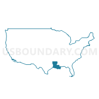
North Delta Regional Planning & Development District 2--Northeast Louisiana PUMA, Louisiana
About
Outline

Summary
| Unique Area Identifier | 193027 |
| Name | North Delta Regional Planning & Development District 2--Northeast Louisiana PUMA |
| State | Louisiana |
| Area (square miles) | 6,127.54 |
| Land Area (square miles) | 5,961.73 |
| Water Area (square miles) | 165.81 |
| % of Land Area | 97.29 |
| % of Water Area | 2.71 |
| Latitude of the Internal Point | 32.45909200 |
| Longtitude of the Internal Point | -91.80425370 |
Maps

Graphs
Select a template below for downloading or customizing gragh for North Delta Regional Planning & Development District 2--Northeast Louisiana PUMA, Louisiana


Neighbors
Neighoring Public Use Microdata Area (by Name) Neighboring Public Use Microdata Area on the Map
- Central Region--Hinds (West), Warren & Copiah Counties--Vicksburg City PUMA, MS
- Coordinating & Development Corporation 4--Northwest Louisiana PUMA, LA
- Kisatchie Delta Regional Planning & Development District 1 PUMA, LA
- North Delta Regional Planning & Development District 1--Ouachita Parish PUMA, LA
- South Central Arkansas PUMA, AR
- South Delta Region PUMA, MS
- Southeast Arkansas PUMA, AR
- Southwest Region PUMA, MS
Top 10 Neighboring County (by Population) Neighboring County on the Map
- Ouachita Parish, LA (153,720)
- Warren County, MS (48,773)
- Lincoln Parish, LA (46,735)
- Union County, AR (41,639)
- Adams County, MS (32,297)
- Morehouse Parish, LA (27,979)
- Union Parish, LA (22,721)
- Ashley County, AR (21,853)
- Concordia Parish, LA (20,822)
- Franklin Parish, LA (20,767)
Top 10 Neighboring County Subdivision (by Population) Neighboring County Subdivision on the Map
- District B, Ouachita Parish, LA (28,088)
- District A, Ouachita Parish, LA (26,793)
- District C, Ouachita Parish, LA (26,704)
- District E, Ouachita Parish, LA (26,595)
- District D, Ouachita Parish, LA (24,124)
- District F, Ouachita Parish, LA (21,416)
- District 4, Warren County, MS (10,169)
- District 3, Warren County, MS (7,557)
- District 2, Warren County, MS (7,286)
- District 4, Adams County, MS (5,408)
Top 10 Neighboring Place (by Population) Neighboring Place on the Map
- Vicksburg city, MS (23,856)
- Ruston city, LA (21,859)
- Bastrop city, LA (11,365)
- Tallulah city, LA (7,335)
- Winnsboro city, LA (4,910)
- Jonesboro town, LA (4,704)
- Lake Providence town, LA (3,991)
- Farmerville town, LA (3,860)
- Rayville town, LA (3,695)
- Delhi town, LA (2,919)
Top 10 Neighboring Unified School District (by Population) Neighboring Unified School District on the Map
- Ouachita Parish School District, LA (104,905)
- Vicksburg Warren School District, MS (48,773)
- Lincoln Parish School District, LA (46,735)
- Natchez-Adams School District, MS (32,297)
- Morehouse Parish School District, LA (27,979)
- El Dorado School District, AR (26,332)
- Union Parish School District, LA (22,721)
- Concordia Parish School District, LA (20,822)
- Franklin Parish School District, LA (20,767)
- Richland Parish School District, LA (20,725)
Top 10 Neighboring State Legislative District Lower Chamber (by Population) Neighboring State Legislative District Lower Chamber on the Map
- State House District 12, LA (47,971)
- State House District 15, LA (47,647)
- State House District 22, LA (46,175)
- State House District 13, LA (42,950)
- State House District 16, LA (42,191)
- State House District 11, LA (42,174)
- State House District 14, LA (41,909)
- State House District 20, LA (41,676)
- State House District 19, LA (40,425)
- State House District 17, LA (38,916)
Top 10 Neighboring State Legislative District Upper Chamber (by Population) Neighboring State Legislative District Upper Chamber on the Map
- State Senate District 35, LA (119,540)
- State Senate District 36, LA (119,479)
- State Senate District 31, LA (117,370)
- State Senate District 32, LA (111,685)
- State Senate District 33, LA (110,088)
- State Senate District 34, LA (101,227)
- State Senate District 24, AR (68,804)
- State Senate District 25, AR (67,292)
- State Senate District 37, MS (55,722)
- State Senate District 23, MS (51,680)
Top 10 Neighboring 111th Congressional District (by Population) Neighboring 111th Congressional District on the Map
- Congressional District 3, MS (756,924)
- Congressional District 2, MS (668,263)
- Congressional District 4, LA (667,109)
- Congressional District 4, AR (654,283)
- Congressional District 5, LA (644,296)
Top 10 Neighboring Census Tract (by Population) Neighboring Census Tract on the Map
- Census Tract 104, Ouachita Parish, LA (9,121)
- Census Tract 9610, Lincoln Parish, LA (6,703)
- Census Tract 106.03, Ouachita Parish, LA (6,356)
- Census Tract 9505, Union County, AR (6,256)
- Census Tract 9501, Jefferson County, MS (6,162)
- Census Tract 9602, Winn Parish, LA (6,146)
- Census Tract 102.02, Ouachita Parish, LA (6,103)
- Census Tract 101.02, Ouachita Parish, LA (6,015)
- Census Tract 9607, Lincoln Parish, LA (5,810)
- Census Tract 9504, Union County, AR (5,764)
Top 10 Neighboring 5-Digit ZIP Code Tabulation Area (by Population) Neighboring 5-Digit ZIP Code Tabulation Area on the Map
- 71203, LA (37,105)
- 71291, LA (32,644)
- 39180, MS (32,603)
- 39120, MS (32,334)
- 71730, AR (32,213)
- 71270, LA (30,887)
- 71202, LA (29,044)
- 71220, LA (23,266)
- 71292, LA (21,541)
- 39183, MS (15,661)